
The rivers of India have played a crucial role in shaping the country’s history, geography, and culture. One such prominent river is the Tapi, also known as the Tapti. Originating in the Satpura Range in central India, the Tapi River traverses through multiple states before merging with the Arabian Sea.
This article aims to provide UPSC aspirants with a comprehensive understanding of the Tapi River, including its geographical significance, historical importance, economic potential, and environmental challenges.
Geographical Features of the Tapi River
The Tapi River, also known as the Tapti, is a prominent river in Peninsular India with fascinating geographical features:
- The Tapi River is the second-largest west-flowing river in Peninsular India.
- It originates in the Multai reserve forest in Madhya Pradesh.
- The river flows approximately 724 kilometers before emptying into the Arabian Sea via the Gulf of Cambay.
- The Tapi River basin spans the states of Madhya Pradesh, Maharashtra, and Gujarat, covering an area of 65,000 square kilometers.
- The basin is characterized by steep, densely forested sections and vast fertile plains.
- The Tapi River has several tributaries on both banks, including major ones like Vaki, Gomai, Arunavati, Aner, Nesu, Buray, Panjhra, Bori, Girna, Waghur, Purna, Mona, and Sipna.
- Important dams on the Tapi River include Ukai Dam (Gujarat), Hatnur Dam (Maharashtra), and Dantiwada Dam (Gujarat).
- The river and its tributaries play a crucial role in irrigation, hydroelectric power generation, and water supply for agriculture and drinking purposes.
- The Tapi River and its basin support diverse ecosystems, agricultural activities, and industrial development in the surrounding regions.
Origin and Course
The Tapi River originates in the Multai reserve forest in Madhya Pradesh, at an elevation of 752 meters. From its source, it flows in a westward direction, traversing through the states of Madhya Pradesh, Maharashtra, and Gujarat. The river covers a distance of approximately 724 kilometers before reaching its endpoint in the Arabian Sea via the Gulf of Cambay.
River Basin
The Tapi River basin spans an area of about 65,000 square kilometers. It encompasses regions in Madhya Pradesh, Maharashtra, and Gujarat. The basin is located on the Deccan plateau and is bounded by the Satpura Range to the north, the Mahadev Hills to the east, the Ajanta Range and Satmala Hills to the south, and the Arabian Sea to the west.
Physical Regions
The Tapi River basin consists of two distinct physical regions: the hilly area and the plains. Densely forested hills characterize the hilly region and include prominent ranges such as Satpura, Satmalas, Mahadeo, Ajanta, and Gawilgarh hills. Conversely, the plains are extensive and fertile, primarily encompassing the Khandesh regions of Maharashtra.

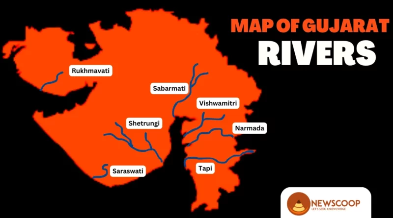
Also Read: Rivers of Gujarat
Tributaries of Tapi River
The Tapi River, also known as the Tapti, is fed by several tributaries that contribute to its flow and overall drainage system. These tributaries can be found on both the left and right banks of the river. Among them, there are 14 major tributaries with a length of more than 50 kilometers. The left bank of the Tapi River features a more extensive drainage system compared to the right bank.
Right Bank Tributaries
The following are the right-bank tributaries of the tapi river:
- Vaki
- Gomai
- Arunavati
- Aner
Left Bank Tributaries
The following are the left-bank tributaries of the tapi river:
- Nesu
- Buray
- Panjhra
- Bori
- Girna
- Waghur
- Purna
- Mona
- Sipna
Dams on the Tapi River
The Tapi River is home to several dams that serve various purposes, including irrigation, hydroelectric power generation, and water storage. Some of the notable dams on the Tapi River are:
- Ukai Dam (Gujarat): Located in Gujarat, the Ukai Dam is one of the largest reservoirs on the Tapi River. It is a multipurpose dam that provides irrigation water to the agricultural lands of Gujarat and also generates hydroelectric power.
- Bhatsa Dam (Maharashtra): Although not directly on the Tapi River, the Bhatsa Dam is an important reservoir in Maharashtra that contributes to the Tapi River’s water supply. It is situated on the Bhatsa River, a major tributary of the Tapi. The dam provides water for drinking purposes to Mumbai city and surrounding areas.
- Hatnur Dam (Maharashtra): Located near Jalgaon in Maharashtra, the Hatnur Dam is constructed across the Tapi River. It primarily serves the purpose of irrigation and provides water for agricultural activities in the region.
- Dantiwada Dam (Gujarat): Situated in Gujarat, the Dantiwada Dam is built on the Banas River, which is a tributary of the Tapi. Although not directly on the Tapi River, it contributes to the overall water resources of the basin.
- Sardar Sarovar Dam (Gujarat): The Sardar Sarovar Dam, one of the largest dams in the world, is constructed on the Narmada River. While it is not on the Tapi River, it is often considered the “twin” or “handmaid” of the Tapi due to its close proximity and shared significance in the region.
Conclusion
In conclusion, the Tapi River holds great significance as a major west-flowing river in Peninsular India. From its origin in Madhya Pradesh to its journey through Maharashtra and Gujarat, the river shapes the landscapes it traverses and provides essential resources for the surrounding regions.
Moreover, the Tapi River and its tributaries play a vital role in supporting agriculture, hydroelectric power generation, and the overall development of the areas within its basin. With its rich history and diverse ecosystems, the Tapi River continues to be a lifeline for the communities and ecosystems that depend on its waters.
Thank You!